The nice thing about being in the recovery period after a race is you can be an awful lot freer about what exercise you take. Instead of carefully-measured and timed outings of six, eight, or even 10 miles, and lots of faff concerning hydration and energy bars, you can go wherever the mood takes you. Briefly, at least.

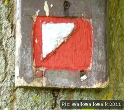
Last weekend was the end of our two-week recovery following the Greenway Challenge half-marathon. We were only down to cover three miles and we thought we’d take the opportunity to run the 4.8km route around the fixed orienteering course in Fairlands Valley Park, Stevenage.
Orienteering is a navigation-based sport that requires participants to find the quickest route over varied terrain between a series of control points. As well as the physical fitness to run across what can be quite rough country you need a sound head for map reading and a very good sense of direction.
Fixed orienteering courses are a great way for beginners to get a feeling for orienteering as well as for people to sample the sport in a less intense way – for example, if you would baulk at charging full-tilt through a muddy forest, or you have children or less able people with you, there’s no reason why you shouldn’t take a fairly gentle walk instead.
It so happens that we have the abovementioned fixed course reasonably close at hand. Fairlands Valley Park is a place with a lot of different aspects to it as the central landscape appears very much man-made, with its clipped grass and artificial sailing lake. However it is fringed by some impressive mature woodland and attracts a wide variety of wildfowl and other birds, and is packed to the rafters with activities for young and old, making it well worth visiting. Parking is free, extensive, and available at two locations depending on which part of the park you want to visit.
If you want to go orienteering, find your way to the park office, which is in the same building as the café, toilets and so on. Hand over £2.50 (the specialist mapping is very expensive to commission) and you will get a copy of the terrain map you need, showing all the possible control points, as well as descriptions of each point and a number of suggested routes to take. You can also plan your own route around these points if this suits your purposes better. As stated earlier, we’d chosen the preordained 4.8km route because it tallied roughly with the distance we needed to cover.
And it was great fun, if a bit frustrating. To deal with the frustrations first: the park is huge, serves a large suburban population, is full of out-of-the-way corners and doesn’t have much in the way of fences. This inevitably means vandalism is a problem, and a few control points had been quite obviously vandalised, largely by being set on fire. It was often possible to see quite clearly that you were in the right place and where the marker post for each point had been. But it made a nonsense of the letter-collecting exercise that was part of the trail.
A couple more were – absent. We couldn’t see any signs of where they should have been. Now, here we will freely admit that we may have been at fault ourselves, simply not looking in the right place. However, both were theoretically in among an immense growth of spring vegetation and we agreed with the Boy Scouts completing the course at the same time as us that this had probably engulfed them. Whatever the problem, it meant that out of the 21 points we should have been able to find, three were clearly vandalised (9, 13 and 21 if you work at Stevenage Leisure and are reading this) and two were mysteriously missing. Failing to definitively collect around a quarter of the things you are looking for is always going to cast a bit of a cloud over the proceedings.
The other frustration was that it’s amazingly hard to switch from the slow, steady running style you adopt to train for endurance events to the switches of speed and pace required from orienteering. This left us feeling mildly unsatisfied with our run, although very satisfied that orienteering was a pursuit we would enjoy. The course is well-planned to take walkers or runners through all the park’s different scenery and the markers are varied enough that hunting is a challenge while visible enough to prevent it becoming a chore. It’s also clear that the park management does work on the Forth-Bridge-painting task of keeping them maintained, since several have clearly been reinstated following earlier problems.
All in all, we’d undoubtedly recommend giving this a try if you happen to live near this fixed course, or any other. It’s probably best not to cultivate a purist attitude to any part of it, however. It may be that you will encounter the odd missing marker, retrace your steps more than once or fnd yourself walking more than you are running.
Also, do try to take a look at an orienteering map before you set out – you can see an example in this Wikipedia article. They really are quite different from OS maps, since they show levels of terrain difficulty with as much priority as terrain features, and are potentially confusing on the ground if you are not primed beforehand.
However, taken in the spirit of a fun and active excursion, or incorporated into your fitness regime as light relief from long runs and heavy gym sessions, it has great potential to extend the range of options you have available and to make exercising more fun. You can learn more about the sport at the British Orienteering website here.