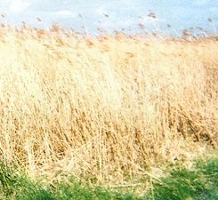
Good morning and welcome back. Walking out of Brancaster, the path makes up for its previous waywardness with a lovely stretch running on a boardwalk through characteristic Norfolk saltmarsh before passing the site of the Roman fort of Branodunum. The sky is endless, the sea’s a mere hint in the distance and there’s a constant undertone of rustling reeds to accompany your every step. This is truly marvellous walking, a glimpse of why this little path can be so rewarding to walk, and it is over only too quickly.
Turning off for Burnham Overy
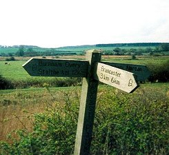
History junkies who get their thrills from rough, tough and dangerous piles of masonry are going to be disappointed by Branodunum. If that’s your thing you need to make your way over to Yarmouth for a look at Burgh Castle (Roman Gariannonum), as imposing a fort as anyone’s heart could desire. No, there’s unfortunately precious little left in terms of physical ruins here – just a few darker patches in the grass and hints of unevenness. But, reflecting the subtler pleasures of this path in general, it’s very rewarding to pause at this quiet spot, perhaps even to lie on the grass in the right weather and stare up through the branches of the spreading tree that overhangs it, and try to imagine what these muddy, obscure Saxon Shore Fort postings must have seemed like to a soldier born and raised on the shores of the Mediterranean. How they must have hated this far northern backwater.
Dunes and silvery sand
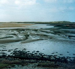
Past Brancaster Staithe (staithe being Old Nuffik for a quay or harbour), which is the sort of place where lucky individuals might very well see seals, and we’re on to a section of the path that is a personal favourite of this site’s authors. The stretch between Burnham Deepdale (one of about 25 Burnhams in very close proximity) and Wells could probably never be described as pretty but we think it shows off the Norfolk Coast at its bleak, beautiful best. The walker leaves the settlement along the top of a broad, curving dyke which gives a high-level view inland to a landscape dotted with church towers and the wrecks of windpumps. Seawards the picture is completely different – mudflats stretching out to a silvery sea a long way on the horizon, wading birds pacing about on the mud then suddenly wheeling off overhead. Off to your left is Scolt Head Island, a national nature reserve with what are considered to be some of the finest saltmarshes in the country. See? It’s not just us.
The approach to Wells
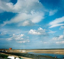
Another detour follows, to get round the back of what was once Burnham Harbour, before it got silted up like almost every other harbour on this coast. Next follows a struggle through the Gun Hill dunes then a memorable trip along what is surely one of the widest and most spectacular sandy beaches in Britain – miles and miles of mudflats and sand (it’s the one used at the end of the film Shakespeare in Love, incidentally). It doesn’t hurt to be aware that the first part of Holkham Beach is a popular naturist beach. Just inland from here and accessible at Holkham Gap is Holkham Hall, a Palladian stately home belonging to the Coke family which is open to the public and has a number of fine walks through its park. Behind the beach a tall plantation of pines act as a wind-break or maybe they help to bind the sandy dunes together. As with all beaches it is up to the walker to find the firmest and most convenient route across, and to dodge the crowds – this can be a fiendishly popular place in warm weather.
A long walk into town
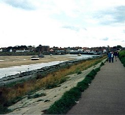
In the meantime, this is our destination for tonight – it’s off to Weybourne tomorrow…