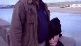
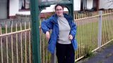
A bit of sun this morning is more than welcome. We’re down here camping, staying at nearby Umberleigh – several years after having done this stage of the South West Coast Path. We have a nagging sense of unfinished business. It’s spring 2008 and the nights are so cold that it’s necessary to sleep fully dressed, wear a woolly hat inside the sleeping bag hood and shake the frost off the flysheet every morning. Bracing does not begin to cover it.
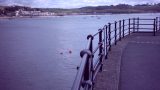
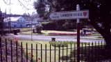
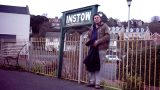
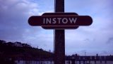
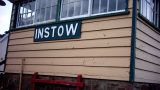
But here in Instow this morning it’s lovely. Our plan is to fill in a gap that’s been nagging away like a missing tooth since, all those years ago, when we came through here with overloaded rucksacks, in a bate because we’d spent three days walking round an estuary in order to travel a net 400 yards. There were no imaginable circumstances under which we were about to attempt a further nine-mile loop of that estuary so (after a spartan night at the youth hostel) we took the bus from Instow to Appledore where we marched on grimly to Westward Ho! and had some chips.
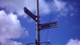
We’ve parked on the seafront with the aim of taking exactly the same bus journey again and walking back. One little job to complete before we do – Instow has a number of geocaches. They’re not fiendishly difficult, and we are soon on our way to the bus stop to retrace our route to Appledore of several years before. The aim is now to walk back round – annoyingly contrarian, since it sends us net east, in contradiction to everything else we have done on this coast. But the logistics simply work better this way.
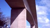
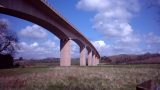
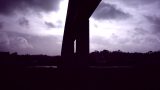
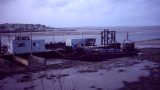
Appledore is full of cheerful teenagers on half-term break. Another stop to pick up a cache, in a hide that really makes us smile, and it’s time to locate the footpath and set off back along the River Torridge. The first section is on paved roads, then the path skirts a shipyard. But when it does emerge onto the shore again it’s at the very beautiful National Trust property of Burrough Farm. After this the path skirts the edges of Northam, passing in front of houses and past lush gardens until it crosses underneath the impressive span of the new A39 road bridge.
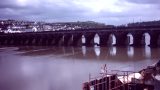
With this behind you the suburbs of Bideford are next, and ahead is the familiar, human-sized and slightly irregular arched bridge that marks the river crossing there. This is a very pleasant town with shops, a park, a museum and lots of maritime interest all perched on the banks of the wide, slow river. Because of its position on the estuary it’s a place that you seem to turn up at again and again if spending any time at all in north Devon. Today it has something that we are very, very interested in – an old-fashioned Wimpy that does all the wonderful desserts we remember from childhood such as Brown Derby and Banana Longboat. You can tell it’s half-term here too – the near-deserted restaurant has the teenage friends of the teenage staff peering through the window, occasionally coming inside and doing their level best to distract them from their work. We have a deeply nostalgic meal and press on.
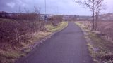
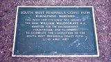
Our obligations to the coast path would be fulfilled if we crossed the bridge and headed back up the river bank towards Instow. But, having come this far, we want to make a bit of a detour. North Devon’s Tarka Trail is a wide, flat path designed for cyclists and walkers to share which runs for more than 30 miles between the settlements of Braunton and Meeth on the beds of disused railways. It runs in pretty much a straight line back to Instow from here, but what we are interested in lies in the other direction.
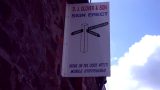
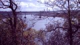
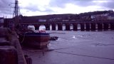
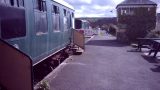
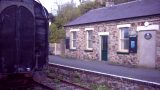
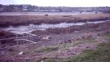
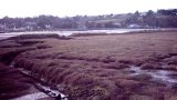
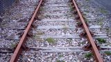
So we cross the bridge, stopping off for another geocache or two, before reaching East-The-Water and seeking the pedestrian access to the path, raised to bridge level at this point. That takes a while but, once up there, we are transported to another world full of gently-decaying train carriages and rural stations with milk churns. A little further on the view opens out across the mudflats that make up a large proportion of the river frontage at this point in the walk. We cross the bridge at Tennacott Farm, which cuts off a wide, Oxbow-style loop, before following the now much narrower and more twisty waterway through a pleasant, wooded section that often runs in cuttings.
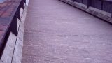
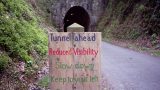
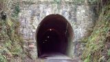
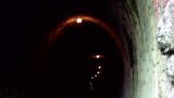
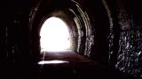
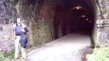
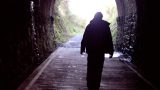
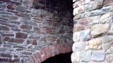
And here’s the thing we came along here to see. There’s a tunnel extant from the time when this was a railway – its stone arch appearing to be an organic part of the hillside, its far end visible as an offset dot of light in the distance as it curves away from the viewer. There’s a notice warning cyclists to slow down and remove their sunglasses. Inside it’s satisfyingly mossy and dank with a string of lights offering a few pools of overhead illumination.
Having achieved our aim of visiting the tunnel it’s time to turn back for Instow. And now the detour seems foolish and the walk back to Bideford a slog, however pleasant the path. As always on these occasions there seems to be a subtle uphil gradient that we didn’t notice when we were walking down. But, despite our grumbles, we are soon back at Bideford and heading in an extremely footsore fashion up the other side of the river.
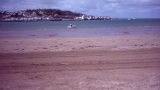
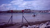
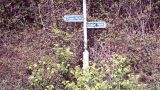
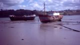
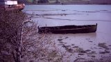
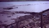
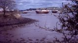
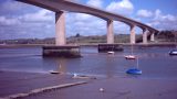
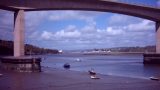
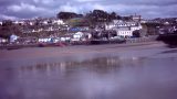
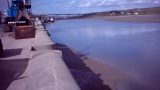
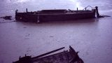
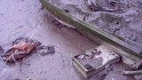
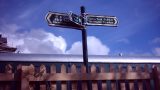
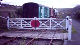
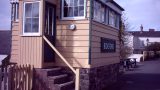
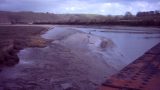
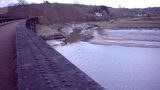
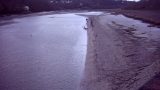
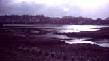
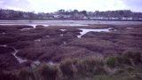
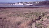
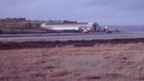
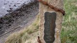
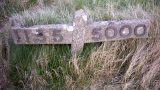
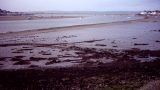
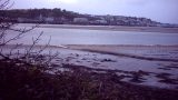
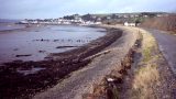
For almost the whole distance it’s a bleak and lovely estaurine landscape as the river widens out to meet its fellows the Taw and the Caen. Re-passing the A39 bridge is a welcome indicator of progress and it looks just as impressive from this side of the water. Visible to the walker’s right soon after is Tapeley Park, a grand house and gardens now open to the public and experimenting with sustainability. Now Instow is visible and, at this late stage in the walk one of the most attractive features to our tired eyes is the remains of old railway furniture such as signal boxes and signs that remind us of the path’s origins.
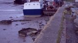
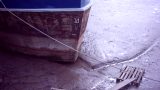
We haul ourselves along the quay, locate the car and sink into it gratefully as the sun sets and the chill starts to descend again. Gosh, sleeping in a tent will be a treat this evening.