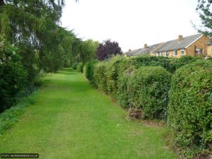
Having risked our necks to reach Wymondley Road we walked a short section of pavement before cutting up a lane, round the edge of a children’s play area then onto a wide, grassy footpath skirting the edge of the Ippollitts Brook. This name refers to a settlement to the south-west of the town that exists in an agreeable nineteenth-century condition of having no standardised spelling, not even on maps. It also has an interesting Roman link which you can read about here.

We were now on deeply familiar ground. The Brook is the childhood play area of one of us, has served during the last few years as the location for several awkwardly-sited geocaches requiring wading, and has been a popular destination whenever we have been visiting nearby and needed a breath of fresh air. We were walking along here when we took the decision to relocate to the town from London.
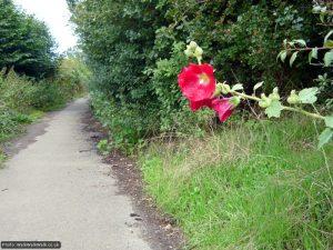
It’s rare, however, that we have travelled the full length of this charmingly-signposted ‘rural walk’ – and what a treat it is in late summer with more ripe blackberries than you can shake a stick at, as well as wild roses and lush vegetation all around. As we neared the end of the path and prepared to emerge onto busy Stevenage Road we saw other blackberriers approaching armed with ice cream tubs and carrier bags – and almost felt like apologising.
Unfortunately, the next section of the HOOP is markedly less pleasant, a necessary condition of a project like this one where sections on busy roads or unremarkable suburban streets will always be necessary to link the sections together. We enjoyed the increasingly rural character of Blackhorse Lane before pausing on a grassy verge for drinks and biscuits.

Soon we were onto a section of footpath linking the south-western edge of Hitchin with the village of Charlton that was completely new to us – something that happened several times during the course of the walk and is therefore an advert for doing it even if you’re a local and think you know the area inside out.
Emerging at the side of The Windmill pub, which had the feeling of an establishment just gearing up for Sunday lunchtime, we took a very brief detour to admire Charlton House and Henry Bessemer’s blue plaque. As we walked down lanes towards the town the surroundings gradually changed from deeply rural to increasingly suburban, becoming inflected with 1970s urban planner around the town centre bypass.
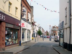
Before we had even fully recognised our surroundings we were sneaking into the town centre through a little-known and, to us, never before used route. Everything shifted into focus when we recognised the beginnings of the mediaeval street plan in front of us and realised we were entering Tilehouse Street, bound for the marketplace via Bucklersbury.

Here our walk description ends – as will yours if you started at the marketplace too. At time of writing there is bunting strung across Bucklersbury to help you celebrate your achievement. Due to our starting point we still had more than half the walk to go at this point and were looking forward to a brief pause for lunch. If you’ve finished, make sure to enjoy some of the attractions of the town before limping back to your car or public transport of choice. And don’t forget – there’s still the Stevenage Outer Orbital (STOOP) and the Letchworth Greenway to go…