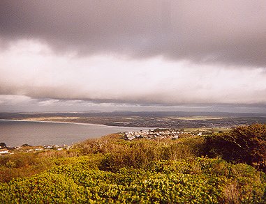
It’s possible, unfortunately, that you will never see an account of the Santiago de Compostela pilgrimage on this site. Like the South West Coast Path, it’s one of Europe’s great walks, but it seems a bit of an impossible task to us at the moment. Not so its junior sibling the St Michael’s Way, however, which runs from 12 miles on various routes between St Ives, Lelant, Penzance and Marazion and has the benefit of reasonable public transport and a Cornwall County Council path guide.
It’s one of a network of rejuvenated pilgrim routes paid for by European funding and the idea was to climb on a boat in Mounts Bay and head for Spain. Sadly, we didn’t do that but the path itself is a little gem – Lelant or St Ives to Carbis Bay, then Bowl Rock, Ludgvan, a choice of routes to Marazion then out to the Mount itself, tides permitting. If you fancy extending your day a little further or taking advantage of transport links, you can then walk along the coast path to Penzance.
St Michael is the patron saint of high places, and is another dragon-slayer like his brother in God, St George. It has been said that this symbolism refers to the fact that many pre-Christian pagan sacred sites were on high places, and the ‘dragon’ slayed by St Michael is in fact the ‘old religion’. Somehow this seems particularly appropriate in west Penwith, with its plethora of standing stones, circles and quoits. Certainly the ruined church on Glastonbury Tor was once dedicated to St Michael too.
From the esoteric to the very prosaic. Cornwall public transport being what it is, we very strongly advise that, should you be using a car, you drive to wherever you want to finish then walk back to your car. That way you are not watching the clock, which is a miserable way to do a lovely walk like this, or risking being stranded and having to sell an organ to pay for a taxi. We parked at Penzance harbour, took the St Ives train up to Lelant and walked back to the car.
- Difficulty: Moderate to strenuous
- Length: from 12 miles, depending on route choices
- Recommended maps: Ordnance Survey Explorer sheet 102 (1:25,000) – Land’s End; Landranger sheet 203 (1:50,000) – Land’s End to Falmouth
- More information: Cornwall County Council tourism pages give details of the path and directions on how to buy a pamphlet with route details.
- Getting around There’s excellent public transport to Penzance from anywhere in Britain courtesy of a mainline rail service. Getting from Penzance to St Ives or Lelant could be achieved from the adjacent bus station. But why bother when you could use the splendid St Ives Bay Line? It’s a decent service but does not run on all days and times, so it’s worth checking beforehand. Also, you can end up with a long wait to change trains at St Erth if there’s no through service, so worth checking this too.