Yesterday we visited a corner of the country that’s not often been on our itinerary – Fenland. The reason: to take a look at one of Britain’s most unusual hillforts, Stonea Camp.

You might expect, given that it’s a hillfort, to find it on high ground. But no. Most of Fenland is below sea level and only kept dry enough to farm by extensive drainage mechanisms which in turn risk drying the land too much and lowering its level still further. Stonea Camp, therefore, is situated on a gravel ‘island’ just a couple of metres above sea level and is the lowest hillfort in Britain. But in Fenland, as we saw, two metres above sea level actually is high ground.
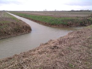
We parked at the side of a country lane and walked down a windy metalled farm track that ran down the side of a large dyke. It is possible to drive right up to the access point on the other side of the fort but, frankly, we were looking to get some walking in. Looking over the flat fields marked out by large drainage ditches it was hard to see where we were headed, even with a map in hand to show us exactly where the fort was.

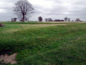
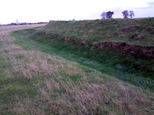
But, having arrived, it was fascinating to learn more about its history. Turning off the farm track for a very brief dash over a ploughed-up footpath (although with its route clearly indicated both by waymarks and on the OS map) we crossed a drainage ditch and walked along a field boundary before crossing a stile and finding ourselves in the camp. Defences against the dry land to the north were ditches and ramparts, the wet territory to the south was cut off by waterways and dykes.
The place had a long history of occupation. In prehistoric times it was thought to be rich in natural resources including salt and one of the area’s dry ‘islands’ suitable for occupation – but became more and more isolated as the waters rose. It was thought to have been a place where the inhabitants of the fens could gather in times of trouble and shows evidence of a brutal battle in Roman times with strong archaeological evidence that the natives were put to the sword. This would fit perfectly with an episode of the Icenian rebellion in AD47, linked to the Roman governor Ostorius, and the Roman historian Tacitus describes just such an episode, but this cannot be definitively confirmed.

The Romans asserted themselves by building a huge tower on the site and a town to the north. But the fort remained occupied through this period with evidence of post-Roman settlement. In more recent times it has seen significant upheaval, being ploughed up for 30 years and having its historic farmhouse knocked to the ground, with nothing now to show where it was except an information board and a patch of rough, uneven ground and darkened grass.
The fort was reinstated in the early 1990s to the condition it had been in before the ploughing took place and is now a scheduled ancient monument through which visitors can wander at will. And we recommend that they do. The place has information boards describing each phase of its history as well as a more general briefing by the entrance on the area and its characteristics.
It’s not a place that occurs to you as a natural spot for walking or archaeology – but it proved very rewarding. Centuries of battles with water levels, an important role in the pressures that brought about the English civil war (Oliver Cromwell started his political career as a Member of Parliament for nearby Huntingdon), a fine habitat for wildfowl and a truly unique landscape which, in its bleak and windswept way, is stunningly impressive.

And, if you are a fan of the hobby of caching, you might find this area worth a visit as well.
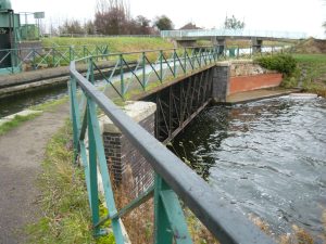
Having visited the camp and located the nearby caches, we moved on to take a look at Mullicourt Aqueduct, a powerful demonstration of shifting land levels in Fenland. Here the Well Creek passes several feet over the top of the Middle Level Main Drain, making it one of very, very few (and perhaps the only) navigable aqueduct in East Anglia. It’s certainly a sight to see and you can learn more about the waterways in the area here.
Two possible future reasons to visit: the local museum with the archaeological finds from the camp as well as much more on the area, and also Seahenge at Lynn Museum, the prehistoric wooden feature removed from the Norfolk coast. And also bird reserves: there’s an internationally-important WWT site at Welney and an RSPB reserve at Ouse Washes. So bring the binoculars.
More on Stonea Camp
- Read its Wikipedia entry
- Cambridgeshire County Council: Sites in Fenland
- View the fort on Google Maps
- Geograph: Stonea Camp
- The Prehistoric Society: Land of the Iceni – The Iron Age in Northern East Anglia. Edited by John Davies and Tom Williamson
- Archaeology Data Service: The Roman stone building at Stonea, Cambridgeshire